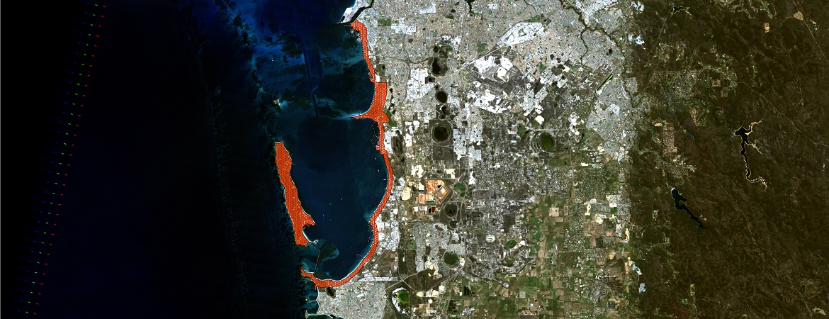
The Coastal Vulnerability & Flexible Adaptation Pathways Project aims to:
- Improve the understanding of the coastal features, processes and hazards of the Owen Anchorage Cockburn Sound (OACS) coast
- Determine the vulnerability of the coast within each coastal compartment based on an understanding of current and future physical changes
- Identify what assets are situated along the OACS coast including the services and functions they provide
- Identify the ‘value at risk’ of assets potentially affected by coastal processes and climate change under different timeframes and scenarios
- Consult with key stakeholder groups and the community to undertake a detailed analysis of most effective and feasible adaptation options which could include coastal protections, planning instruments and market interventions
- Facilitate an understanding of coastal hazards and risk management amongst key stakeholders and community, and
- Incorporate the results of the project (scientific information and consultation output) into existing decision making frameworks and physical works being undertaken in the coastal environs.
The Project consists of a preparation phase and four stages (left click on figure below to enlarge):
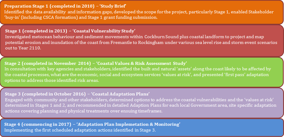
Preparation phase – Coastal vulnerability study brief involved the preparation of the Coastal Vulnerability Study Brief and background report that provided a useful knowledge transfer to the respective partners as to the availability of coastal data and key steps for undertaking a coastal vulnerability assessment. The following documents are available to download:
Background Report
Summary Document
Stage 1 – Coastal Vulnerability Study involved the analysis of coastal processes (meteocean and sediment transfer regimes) to improve the understanding of existing coastal dynamics. Potential changes arising from climate change (from present day to 2110) were assessed to determine the vulnerability of sections of the coastline to erosion and/or inundation. Erosion and inundation hazard maps were developed to show the extent of coastal inundation and erosion at different time frames and scenarios. The timeframes selected were present day, 2070 and 2110 consistent with the West Australian State Planning Policy SPP 2.6 (Schedule 1, Section 2). The selected sea level rises scenarios for these timeframes were 0m, +0.5m and +0.9m respectively. Additionally, a sea level rise of 1.5m at Year 2110 was also selected to determine high-end (worst case) sensitivity. Stage 1 was completed in early 2013. The Executive Summary is available to download.
Register now to get access to the Hazard Maps and the Stage One Report
Stage 2 – Coastal Values & Risk Assessment Study identified the coastal assets affected by coastal hazards (coastal processes and climate change) erosion and inundation. A risk assessment of likelihood and consequence of the identified hazards was then undertaken and the ‘value at risk’ of assets at threat from coastal hazards was identified. Following this a first pass assessment of potential adaptation options for those assets at risk was undertaken. Stage 2 was completed in November 2014. The following reports from Stage 2 are available to download:
Executive Summary
Stage 2 Report
Appendix A
Appendix B
Appendix C
Appendix D
Appendix E
Appendix F
Appendix G
Stage 3 – Adaptation Plan Development refined the adaptation options developed in Stage 2 by consulting with interested stakeholder groups and the broader community. This included identifying ongoing monitoring program needs and recommending improvements to local coastal management strategies and plans. Stage 3 was completed in November 2016. The following reports are available for download:
Stage 4 – Implementation and Monitoring will involve the implementation of the first scheduled adaptation actions identified from Stage 3 including management plan reviews and initial on-ground works such as dune vegetation planting in identified areas to increase system’s resilience to coastal processes. Stage 4 is ongoing.
Funding
Grant funding has been critical to advance the various stages of the Project. Funding for Stages 1, 2 & 3 was provided by WA Department of Transport Coastal Adaptation and Protection Grants and by contributory funds from the Alliance members. The Department of Planning (Coastwest) has also provided funding for Stage 3.